
Below is a listing of backpacking or away trips. The brief descriptions are provided to assist you with trip ideas. All of these trips are multi-days trips and may involve a drive of up to several hours. Click on a title to go to its description.
A few caveats: The descriptions are not intended to be comprehensive and should not be exclusively relied upon for navigation purposes. The Tahoe Donner Hiking Club is not responsible for the completeness or accuracy of the descriptions. Trail conditions can change over time, and navigational trail markers disappear. The difficulty designation may not apply to your capabilities. All backpack trips, except those specifically designated as “beginner” or “intermediate”, are strenuous or very strenuous.
Safety concerns: You are always responsible for your own safety–whether you hike with the Club or on your own. It is recommended to hike with a buddy and to carry a map and GPS (see Guidelines for Hikers); this is especially true for backpack trips. Before leaving home for a multi-day trip, research the route thoroughly. The hike facilitator has the ultimate authority to decide whether a hiker is fit for the trip.
Enjoy and happy trails!
Away Trips
Backpacking Trips
- Beginner – Gourmet Carson Pass to Lake Loop
- Beginner – Lock Leven Lakes Trail
- Beginner – Shealor Lake
- Beginner – Wrights Lake to Twin Lakes
- Intermediate – Leavitt Meadows to Cinko Lake
- Intermediate – Meeks Bay to Emerald Bay
- Intermediate – Mt Rose to Mogul
- Intermediate – Three Sisters Wilderness (Oregon)
- Intermediate – Paradise Lake
- Intermediate – PT Reyes
- Intermediate-Advanced Oregon PCT from Crater Lake to Windigo Pass
- Advanced – JMT from South Lake TH, exit on Taboose Pass Trail
- Advanced – PCT Sonora Pass South
- Advanced – Oregon PCT & Eagle Creek from Timberline Lodge
Descriptions
AWAY TRIP: Castle Crags State Park and PCT (3 day hikes, car camping or motel)
DISTANCE: 7 mi, 17 mi, 5 mi depending on hike
ELEVATION CHANGE: Different for each hike
DIFFICULTY: Moderate/Strenuous
DESCRIPTION: Three day hikes through, in, and near Castle Crags State Park. Two hikes are on the PCT and one is to a viewpoint of the Castle Crags formation. Mt Shasta is nearby, and wildflowers should be in season. Contact trip facilitator for more information
MEETING PLACE/TIME: Trip headquarters will be in the Castle Crags campground
TRAILHEAD: Different for each hike
LINKS: n/a
DOGS: Not permitted in Castle Crags State Park
Go back to Backpack and Away trip List
BACKPACK: Leavitt Meadows to Cinko Lake
DISTANCE: 30 miles Out and Back
ELEVATION CHANGE: +1,500′
DIFFICULTY: Moderate
DESCRIPTION: This five day and four night trip offers splendid upcanyon views as you skirt Leavitt Meadows, leads to four destination-worthy lakes, and follows some beautiful stretches of the West Fork of the West Walker River. Nights two and three will be in same spot, allowing a longer day hike to Cinco Lake on day three.
TRAILHEAD: Leavitt Meadows Trailhead on Highway 108, 7 miles west of Highway 395.
LINKS: “Sierra North” by Elizabeth Wenk & Mike White at
https://books.apple.com/us/book/sierra-north/id1511455902
DOGS: Yes
NOTES: Bring a water filter as there should be plenty of water along the way.
1. Backpack, Tent and related equipment, including a bear canister. There are several outdoor stores that rent backpacking equipment.
2. Water for backpacking trip (recommend at least 2 liters per person for drinking).
Go back to Backpack and Away trip List
BACKPACK: Lock Leven Lakes Trail
DISTANCE: 8 miles out and back
ELEVATION CHANGE: +1,000′
DIFFICULTY: Moderate
DESCRIPTION: The Loch Leven Lakes Trail is a moderate 8-mile out-and-back hike which features beautiful vistas of 3 alpine lakes. The trail begins at 5800’ elevation just west of the Rainbow Lodge, and the elevation gain to reach the first lake is about 1000 feet. The terrain is quite flat to the other 2 lakes. We will set up camp at Middle Loch Leven Lake, which we believe is the loveliest. Unencumbered by our backpacks, we will then take a short walk to High Loch Leven Lake, where the swimming is excellent. Returning to our campsite, we will feast on our favorite backpacking foods for dinner. The next morning, after breakfast, we will pack up and hike back down to the trailhead.
TRAILHEAD:
LINKS: Alltrails map
DOGS: No
NOTES: Must Have’s for the Trip
1. Backpack, Tent and related equipment, including a bear canister. There are several outdoor stores that rent backpacking equipment.
2. Water for backpacking trip (recommend at least 2 liters per person for drinking).
3. Food for dinner on Monday evening and breakfast on Tuesday morning.
Go back to Backpack and Away trip List
BACKPACK: Paradise Lake
DISTANCE: 7 Miles to campsite + 6-8mi day 2
ELEVATION CHANGE: ~1500’
DIFFICULTY: Moderate
DESCRIPTION: Paradise Lake 2 night easy to moderate backpack. We will pack up Castle Peak road to the PCT to Paradise Lake, about 6-7 miles moderate terrain and set up camp on the beautiful granite shelves next to Paradise Lake. The second day we will do a day hike of around 6-8 miles round trip to Whiterock Lake with just a day pack and return to Paradise Lake for a second night. (There is also an option to bushwhack down to Warren Lake from Paradise.)
The last morning we will pack out the same PCT trail.
All in all this is a nice introductory backpack with gorgeous scenery, great swimming and just one camp set up for the two nights.
TRAILHEAD: Castle Peak Road off I-80
LINKS: Paradise Lake
DOGS: Yes
Go back to Backpack and Away trip List
BACKPACK: Pt. Reyes
DISTANCE: 6 Miles to campsite
ELEVATION CHANGE: +?’
DIFFICULTY: Moderate
DESCRIPTION: Hike starts in Bolinas, about 4 hrs from Truckee, meet and hike in ~6miles to the Wildcat Camp campground. On day 2 and 3, hikers can choose from a variety of day hikes (many lengths) or just relax. Beach walking is great and Alamere Falls is 1 mile down the beach. On day 4 (23rd), we will break camp and hike back out to the trailhead. Note: Campground has vault toilets and good running water.
TRAILHEAD: TH is approximately 4 hours from NW Clubhouse. Polomarin Trailhead in Bolinas.
LINKS: Map of Palomarin Trail Maps of Trailhead
DOGS: Yes
Go back to Backpack and Away trip List
BACKPACK: JMT (John Muir Trail) section accessed from South Lake TH, JMT south, exit on Taboose Pass Trail
DISTANCE: 46 miles
ELEVATION CHANGE: ~6700 ft up (mostly done in 2 days); ~11000 down (-6400 ft last day on Taboose Ck Trail)
DIFFICULTY: Strenuous to very strenuous
DESCRIPTION: Challenging. 2200 ft climb day 1 to Bishop Pass, 3200 ft descent to Le Conte Station, 4000 ft climb to Mather Pass, up/down on JMT to Taboose Pass, 6400 foot descent. Most of trek is above 11000 ft. Vegetation from pine-fir forest to subalpine. Bear canister is required.
MEETING PLACE/TIME: Arrangements for starting time, duration and car pooling TBD.
TRAILHEAD: Trek begins at South Lake TH
LINKS: n/a
DOGS: No
Go back to Backpack and Away trip List
BACKPACK: Intermediate-Advanced Oregon PCT from Crater Lake to Windigo Pass
DISTANCE: 31.4 mi
ELEVATION CHANGE: +/-1500′
DIFFICULTY: Blue/Black
DESCRIPTION: Day #1: Backpack 8.4 miles north from OR 138 (just north of Crater Lake) and camp at Thielsen Creek. Backpack 10.6 miles to Maidu Lake. Backpack 12.4 miles to Windago Pass and a waiting car.
MEETING PLACE/TIME: Shuttle
TRAILHEAD: OR 138 – North Crater Trailhead. The short road that goes NE to the TH starts from OR 138 just 0.8 miles east of Crater Lake’s north-rim access road.
LINKS: PCTA.org
DOGS: Yes
COMMENTS: *8 total hikers* Please sign up by August 1 to help determine logistics.
Go back to Backpack and Away trip List
BACKPACK: PCT Sonora Pass south to Kerrick Meadows Trail to Rock Island Pass to Crown Lake to Twin Lakes (Mono Village Resort)
DISTANCE: 54 Miles (6 Days, 5 Nights)
ELEVATION CHANGE: 3000’
DIFFICULTY: Strenuous
DESCRIPTION: A wonderful semi-loop with terrific views, good trails, nice creeks and lakes and a reasonable car shuttle.
MEETING PLACE/TIME: Drop off at Northwoods clubhouse 6 am
TRAILHEAD: Hwy. 108 Sonora Pass – PCT
LINKS: n/a
DOGS: No
Go back to Backpack and Away trip List
BACKPACK: Two-Day, One-Night “Beginner Gourmet” Backpack
DISTANCE: 10 miles total (5 miles each day)
ELEVATION CHANGE: 1400 ft. or 2000 ft., depending on destination chosen
DIFFICULTY: Moderate
DESCRIPTION: We will first travel to the Kirkwood Inn & Saloon for a hearty Sunday brunch. Then up to Carson Pass to begin our backpack. If we can get permits for the Mokelumne Wilderness, we will hike South to Fourth of July Lake. If we cannot get permits, we will head North to Round Lake. Either trip is about 5 miles one way. After camping overnight, we head back out to Carson Pass on Monday morning. Before heading back to Truckee, we will stop at Sorensen’s Resort for lunch.
MEETING PLACE/TIME: Northwoods Clubhouse, 8:00 a.m.
TRAILHEAD: Kirkwood Inn & Saloon, 10:00 a.m.
NOTE: Limited to 8 participants
LINKS:n/a
DOGS: No
Go back to Backpack and Away trip List
BACKPACK: Meeks Bay to Emerald Bay 3 day/ 2 night Intermediate Backpack
DISTANCE: 20-22 miles total
ELEVATION CHANGE: unknown
DIFFICULTY: Moderate, except Strenuous over Phipps Pass
DESCRIPTION: We will start at the Meeks Bay trailhead and hike to Stony Ridge Lake for the first night, a distance of 6.5 miles. On the second day, we will go over Phipps Pass, then on to Dick’s Lake. Then on Day 3, we hike out to Emerald Bay. Since we are ending at a different location than where we started, this trip will require a car shuttle.
MEETING PLACE/TIME: Northwoods Clubhouse, 8:00 a.m.
TRAILHEAD: Meeks Bay Trailhead, 9:00 a.m.
SPECIAL NOTES: 1. Limited to 8 participants 2. Permit fees are $10.00 per person
LINKS:n/a
DOGS: No
Go back to Backpack and Away trip List
BACKPACK: Mt Rose to Mogul 3 days/2 night Intermediate Backpack
DISTANCE: approximately 30 miles
ELEVATION CHANGE: Day 1 2 climbs of 1000 feet each, then mostly downhill
DIFFICULTY: Moderate to moderate +
DESCRIPTION: Shuttle drop off, pick up to be arranged.
LINKS:n/a
DOGS: No
Go back to Backpack and Away trip List
BACKPACK: Moderate Three Sisters Wilderness 5 days/4 night + 2 travel days
DISTANCE: 50 mile loop
ELEVATION CHANGE:
DIFFICULTY: Moderate
DESCRIPTION: This loop circles the North, Middle, and South Sister volcanoes providing a fantastic array of diverse terrain. Take this amazing journey and wander through rugged volcanic landscapes complete with expansive pumice fields, pristine melt lakes, quiet old-growth forests, newly recovering burn areas, peaceful wildflower meadows, and glossy obsidian streams. This is truly an Oregon adventure than cannot be missed.
MEETING PLACE/TIME:
TRAILHEAD:
SPECIAL NOTES:
LINKS:n/a
DOGS: No
Go back to Backpack and Away trip List
BACKPACK: Beginner – Shealor Lake 3days/2 night
DISTANCE: Approximately 3 miles RT; Optional days hikes
ELEVATION CHANGE: 700 ft elevation gain.
DIFFICULTY: Easy to moderate
DESCRIPTION: Shealor Lake is a well-documented destination off highway 88 about 2 hours from the Northwoods Clubhouse. From the trailhead, the hike is uphill at first and then down-hill to the lake. The high point is half-way to the lake Water from lake should be filtered before drinking. Campfires were not allowed. Of course, camp stoves are allowed. Swimming in the lake is a must for kids and adults who still feel like kids. Fishing is said to be good. There are several day hikes to other lakes or to great view sites. Lazing around the campsite is allowed.
SPECIAL NOTES: Note on sign-in if interested in an hike backpack orientation scheduled about a month in advance
LINKS: AllTrails US Forest Service Hiking Project
DOGS: Yes
Go back to Backpack and Away trip List
BACKPACK: Wrights Lake to Twin Lake
DISTANCE: less than 3 miles
ELEVATION CHANGE: 1000’
DIFFICULTY: Easy
DESCRIPTION: Wrights Lake to Twin Lakes beginner 2 night backpack
TRAILHEAD: Wrights Lake Campground *Note: parking is very limited at trailhead.
LINKS: none
DOGS: No Dogs
Go back to Backpack and Away trip List
BACKPACK: Advanced – Oregon PCT & Eagle Creek Trail from Timberline Lodge to Cascade Locks
DISTANCE: 49 Miles
ELEVATION CHANGE: ~5,000’
DIFFICULTY: Strenuous
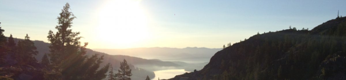
DESCRIPTION: In this short section, you traverse around Oregon’s highest and most popular peak – Mt. Hood! At Wahtum Lake, leave the PCT and take the unusually dramatic Eagle Creek Trail with its abundant waterfalls within a steep walled canyon, down to the Columbia River Gorge.
MEETING PLACE/TIME: arranged with hike facilitator
TRAILHEAD: Timberline Lodge
LINKS: n/a
DOGS: No
Go back to Backpack and Away trip List